

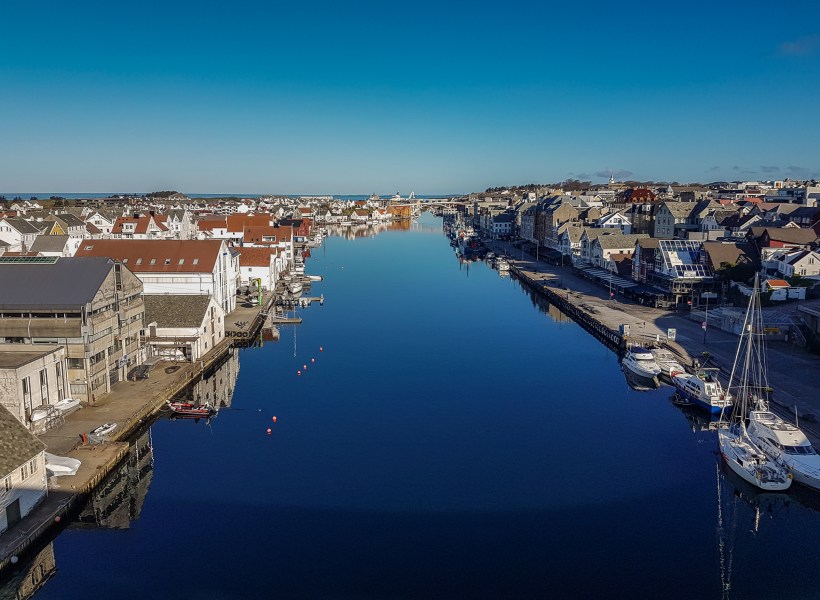
22 Sept 2018 2 day trip Aprox 1454km/903mi
photo by Jone Haakonseth ©
MAP
As always, good weather is strongly wanted when setting off on new adventures, especially when traveling in beautiful natural surondings like Norway.
This time Sven had planned a trip to a little place called Skjolden, located in between two national parks, Jotunheimen National Park in the east and Jostedal National Park in the west.
The plan was to explore some gravel roads in the area, and get some cultural refill at the same time, not a bad combo at all.
Saturday, and early bird start at 09.00 to make the most of the day, weather was good, and things could only get better.
Since the first part of this journey is well familiar to us, we did more or less transport the first section all the way up to Voss.
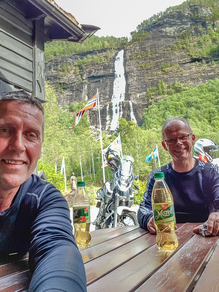
Short lunch stop just outside Voss, refueling of man and machine is necessary in between. The gas station at Vinje has become a regular stop on our trips, good food and a nice view overlooking Strandaelvi is allways appreciated. This river runs all the way down to Voss, and is used a lot for extreemsports.
Check out this page to see some of the activities for this area. Ekstremsportveko
The journey trough Viking Valley/God Valley is always amazing, and we passed by Stalheimskleiva, as we always do…read more on this place here.
Click on small images to see a larger pictureshow


In Aurland we took the old road over Aurland mountain instead of going trough the worlds longest road tunnel, Laerdalstunnelen.
Here`s some photos from Aurlandsfjord, Flaam and Aardal
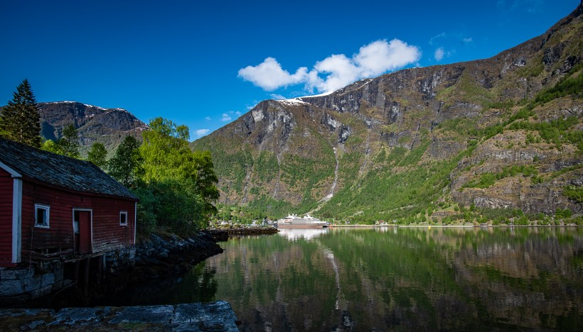
Flaam, 
Aurlandsfjord 
Aurlandsfjord 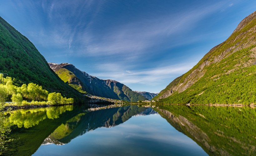
Aardal
Aurland mountain road is one of 18 National Tourist Routes in Norway, and can be really cold, even during summertime. It is called “Snow road” due to the fact that one can experience snow along the road all trough the summer.


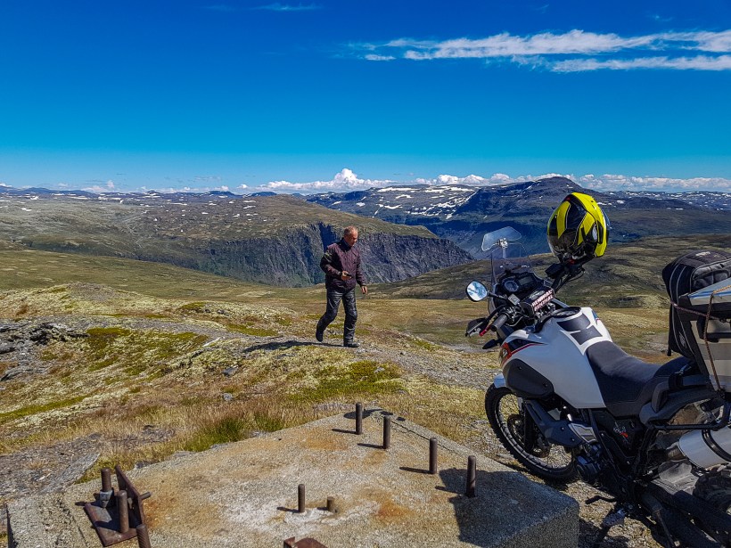


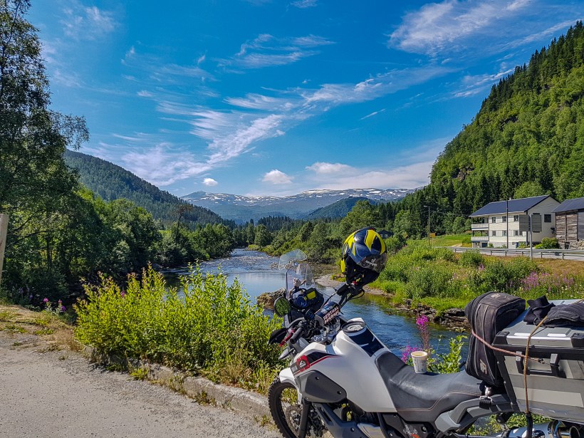
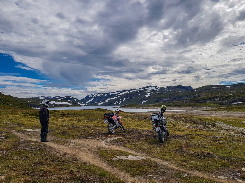
Heading on from Laerdal, we had to check out some nice gravel roads just outside of Aardal. There is a road up here called “the 1000meter” due to it`s location, running along the mountainside at high altidtude, a 1000 meters up 🙂 This road is closed of for normal traffic due to lots of rock slides, and is a very dangerous place to drive. Aardal is also a very scenic place, with lots of beautiful nature to view.
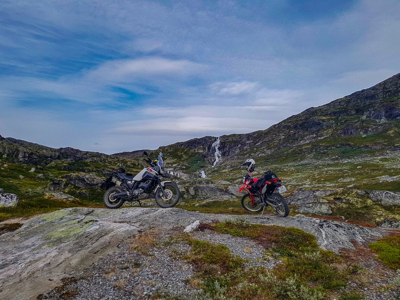
Now from Aardal over to Turtagroe there is a nice stretch of road, privately maintained, called Tindevegen. This is also a very spectacular piece of road that needs to be experienced first hand. It`s a 32 km long and winding tourist road, that takes you from Sognefjorden to Jotunheimen. The road is also called “the shortcut through Jotunheimen” and suitable for cars, RV and smaller busses (max 10m). The road is open from May to November and is a toll road.
more info here…..
On the other side of Tindevegen you arrive at Turtagroe which basically is a very good starting point to explore some of the highest mountains in Norway. Turtagrø is considered the best starting point for trips to Hurrungane, the mountain area which is loved by mountain sportsmen, top skiers and climbers. Turtagrø is considered to be the place in Norway where the mountain sport started. Especially popular is Turtagrø among climbers, as many of the mountains here require excitement with climbing equipment and expertise to reach the top. At the same time, Hurrungane tours have many beautiful walks that do not require climbing. Fannaråki, Store Dyrhaugstind and Nordre Skagestølstind are examples of trips near Turtagrø that do not require climbing skills, but provide great views of Hurrungane .
Here`s a link (in Norwegian) to some nice pictures of the aerea.
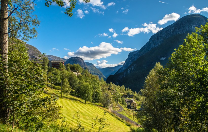
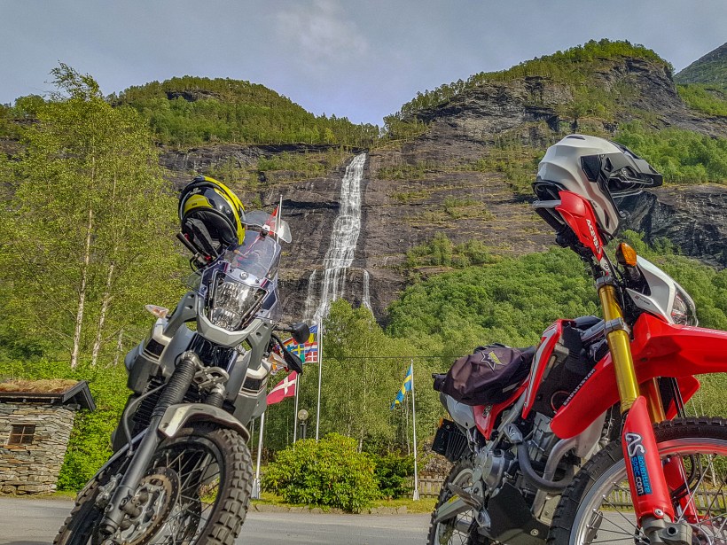
Next up is our camp for the night, and at Skjolden there`s a nice selection of camping sites and hotels to choose from. We got settled in, and went for dinner at a local cafe, located directly under a nice waterfall. Good food, and nice scenery at Vassbakken Kro
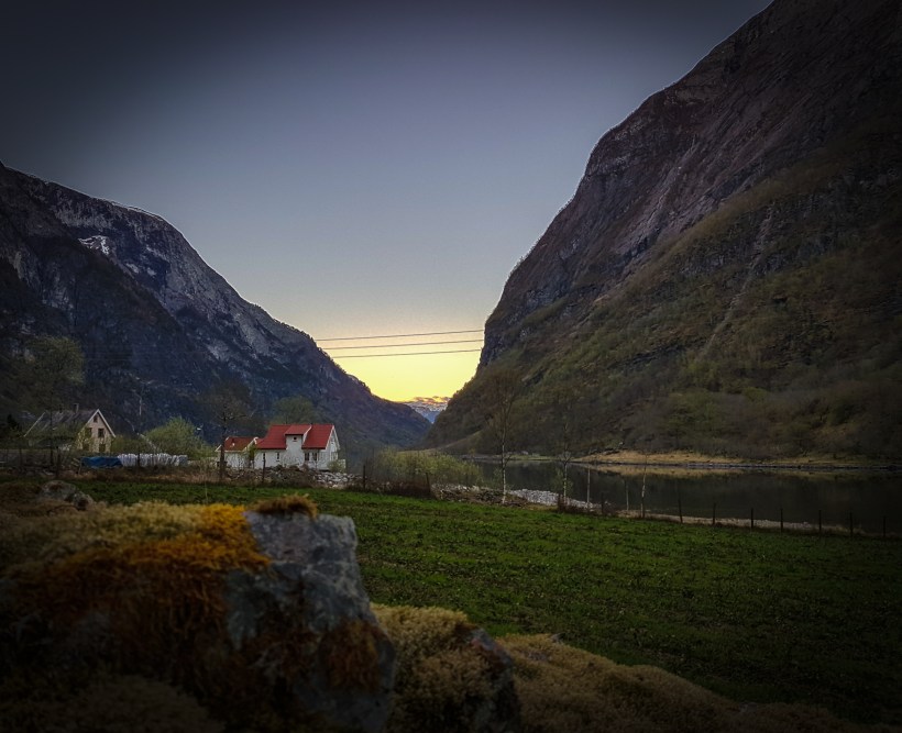
New day, and now we set sails for Jostedalen and Nigaard Glacier. Riding along Sognefjord is always wonderful and scenic in good weather. Between Skjolden and Gaupne you pass an old sanatorium, this you can, and should, visit if possible. Harastølen has a rumer for being haunted and is located far up in the hillside.
In 1896, the board of St. Jørgens Hospital in Bergen decided to build a hospital for “poor corrosion sickness in Bergen’s diocese”. The Harastølen was opened on November 2, 1902, under the name “Lyster Sanatorium”. The building costs were NOK 777,000, which was a considerable sum in that time. At the opening, the sanatorium had 96 beds. In 1924 the capacity was expanded to 120 beds, in 1950 to 150. The building is about 5000 m2 [2] The building was designed by Adolph Fischer. It is located on the hillside, 500 meters above sea level, above Luster. One reason for the location was the favorable climate inside Lustrafjorden. In addition, one was early aware of the importance of hydropower, and in this respect, Luster sanatorium had one of the very first private water turbines in Norway. From the steamship cabin in Luster, an electric cable car went up to the sanatorium. A seven kilometer road with thirteen hairpin turns also leads up to Harastølen. The cable car was in operation until the beginning of the 1990s. Due to its location and the danger of infection, there was a separate community at Harastølen, and the institution was self-sufficient with electricity from the water turbine. Eventually, a resident’s residence, sister residence for the employees, two family residences for lighthouse and gardener, chapel with mortuary, post office, laundry, ice house and stables. In 1937, Jacob Kjøde and other rich people from Bergen donated their own film screening apparatus to the institution, and there was a cinema night once a week. The library had 17,000 titles. The institution also had its own pig shed, and when the diet made the patients gain weight, it was ensured that the pigs had an extra layer of blubber. Just after World War II, the drug came streptomycin, which virtually eradicated the tuberculosis, and the basis for the operation disappeared. The building was then used as a psychiatric hospital. From 1991, Harastølen was left empty, as Gaupne’s old buildings from power development were empty, and these became new premises for psychiatric hospitals.
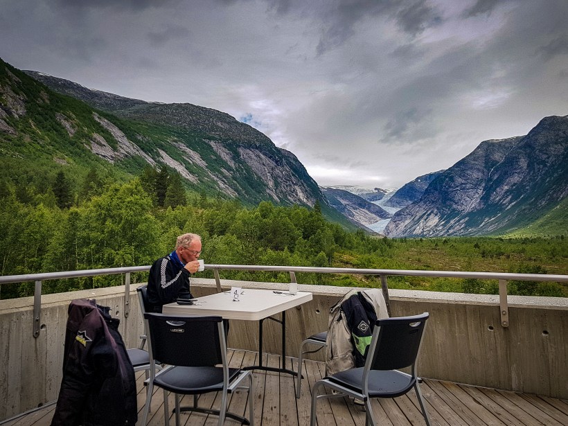
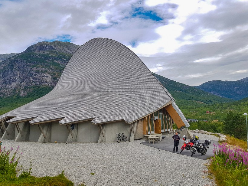
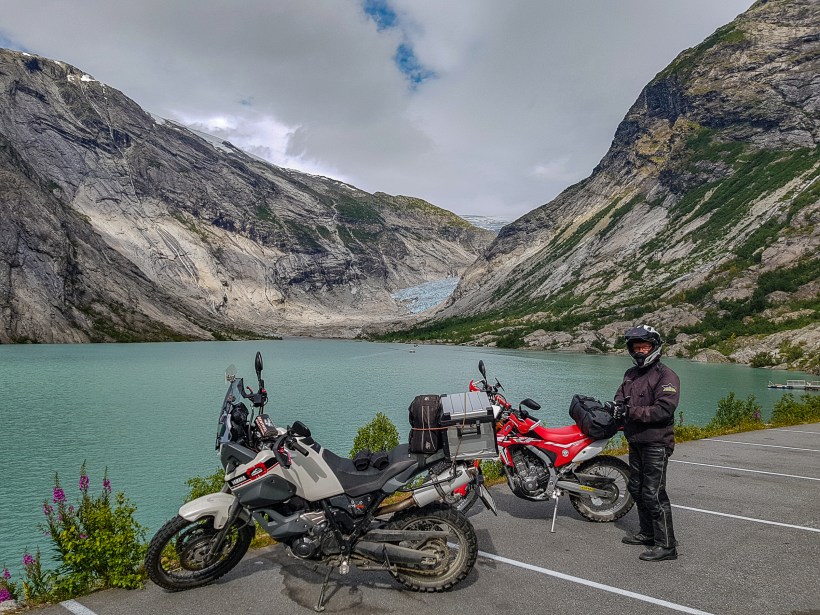
In Gaupne you make a right turn up Jostedalen, and the road winds its way up alongside Jostedoela river. It is a long and winding road with lots of scenic views, and aprox 30 km up the valley you arrive at Breheimsenteret. From here you can go Glacier hiking, Kayaking, Rafting, Mountain hiking, Blue Ice Cave, Skiing and Molden hike among other things.
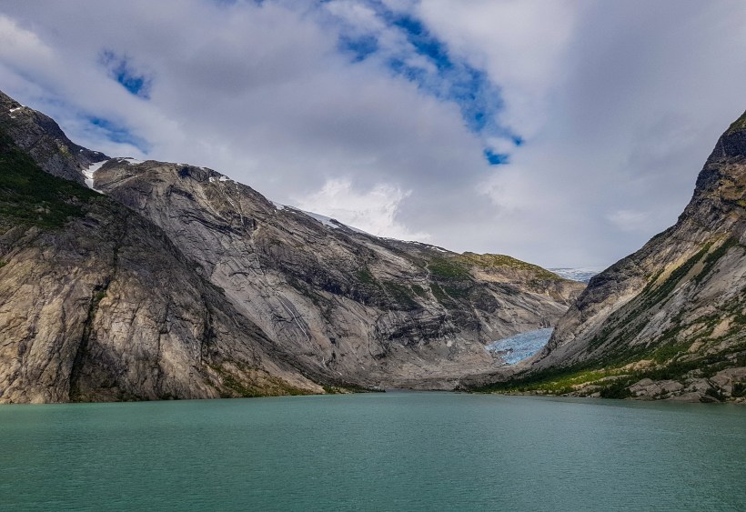
We drove up as far as the road took us, and got a spectacular view of Nigard Glacier, or at least parts of it, its big. We also had a fantastic pizza at Breheimsenteret, highly recommended. Great food an unbeatable view.


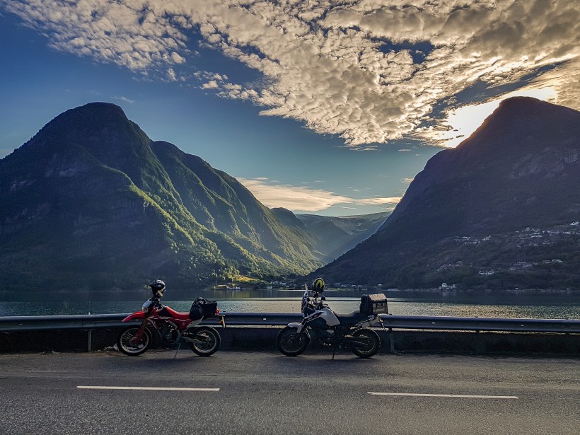
Next on our list was a little exploration of Vikamountain. The road took us out westbound alongside Sognefjorden. At Hella you get on the ferry and cross the fjord over to the south side. Waiting for the ferry, one just have to sit in awe of the nature that surronds Sognefjorden….


On the other side of the fjord a little place called Vik i Sogn awaits.
This small village is known for it`s 3 churches. One stave church, one stone church and on ordinary church.
Hove church is the oldest stone building in Sogn and is one of the oldest in the country. It is dated to the end of the 12th century. Church has name after the farm Hove. Rich burial finds from Roman times peek out Hove as an early ruling site in Vik, and historians thinks the church could be built by a prominent landlord as a private guard church.
Hopperstad stavkirke is a stave church with raised central room which stands on the farm Hopperstad near Vikøyri in Vik municipality, Sogn og Fjordane county in Norway. The stave church must be built around the year 1130, and it stands on its original grounds.
So DO stop by here.

Next up is Vikafjell. This road can be closed on short notice during winter, this due to high altitudes and rapidly changing weather.
Vikafjell is a mountain area in Vik municipality, Sogn og Fjordane. Vikafjellsveien Rv 13 forms the border with Stoelsheimen in the north. Power development has left its mark on the areas closest to Vikafjellsveien.
The mountain crossing at Rv 13 Voss-Vik is very hard. In the National Transport Plan, NTP from 2018, there is a plan for the construction of the Vikafjell tunnel at 2.8 kilometers between Vik and Vangsnes.
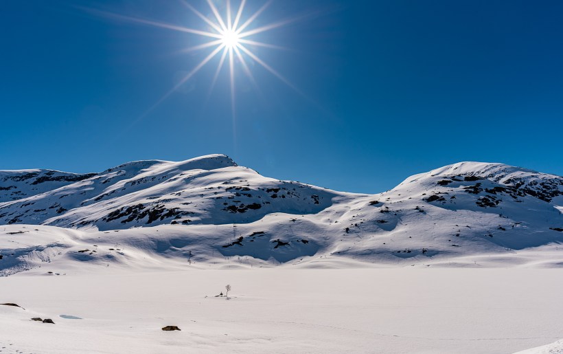
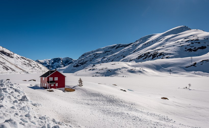
The winter pictures has been taken on a previous trip, but just to show you how it can be in wintertime.
We got to explore some nice gravel roads up there as well.


So, last leg of our journey was home to Haugesund. When you come down of the mountain you can head out west to Voss again, and from there it was a matter of transporting our buts back home 🙂
We did make some short stops to eat and fuel up, and also a short stop to take a shot of beautiful BuarGlacier, just outside Odda
I`ll leave you for now with a nice nightshot of Voss….
Til next time, stay healthy and keep travelling 🙂 Jone


Wow what amazing landscapes. This looks like a stunning place to ride.
LikeLike